| Inventory Number: | GA/10-06-10x | | TLF Number: | 19D | | County: | Banks County | | Township: | | | Town/Village: | Salem Church | | Bridge Name: | New Salem Church | | Crosses: | Gun Creek / Grove Creek | | Truss type: | Queen | | Spans: | 1 | | Length: | 46' | | Roadway Width: | | | Built: | after 1937 | | Builder: | William Madison Thomas | | When Lost: | Spring 1984 | | Cause: | Collapsed | | Latitude: | N34 15.522 | | Longitude: | W083 25.345 | | See a map of the area
Topographic map of the area | | Directions: | ½ mile east of route 59 and 1½ miles south of route 64 on CR227. |
|
New Salem Church Bridge, Salem Church, Banks County, GA Collapsed Spring 1984
Trish Kane/Richard Donovan Collection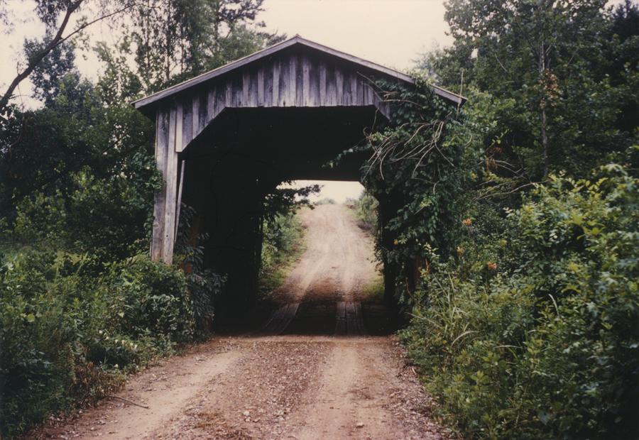
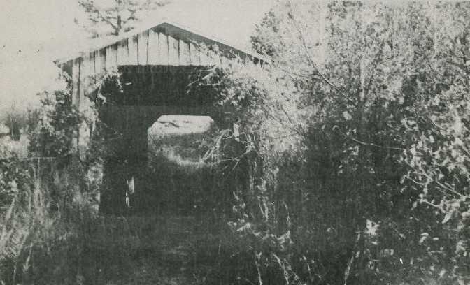
New Salem Church Bridge, Salem Church, Banks County, GA. Built after 1937 Collapsed Spring 1984
July 1966 Photo, Palmer Werner Collection
|
Sources:
Lane, Oscar F.. World Guide to Covered Bridges, 1972, page 7
French, Thomas L., Jr. & Edwards. Covered Bridges of Georgia, 1984, pages 21-22
National Society For the Preservation of Covered Bridges. Covered Bridge Topics, Volume XXXVI, No. 3, Summer 1978, page 7 |