Documenting North America's past & present covered bridges


Home

Point Wolfe, Albert County

If you find errors in the data please contact Bill Caswell.

If you would like to provide information on covered bridges that no longer exist from your state, or adopt a state to work on, we would certainly welcome your assistance. Please contact Trish Kane for more information.

Inventory Number: NB/55-01-05x
County: Albert County
Township: Alma
Town/Village:
Bridge Name: Point Wolfe
Crosses: Point Wolfe River
Truss type: Howe
Spans: 1
Length: 95', 29m
Roadway Width: 17'
Built: 1916
Builder:
When Lost: 29 Dec 1990
Cause: Destroyed
Latitude: N45 33.036
Longitude: W065 00.776
See a map of the area
Topographic map of the area
Directions: 4.7 miles (7.6 km) southwest of NB114 and main entrance to Fundy National Park on road past Park headquarters.

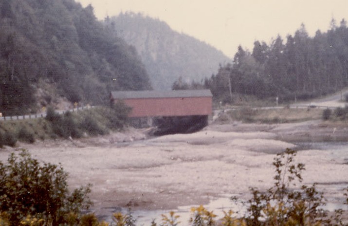
Point Wolfe Bridge, Albert County, NB Destroyed 1990, rebuilt
Raymond Brainerd Photo, Richard E. Roy Collection
Comments:
The Point Wolfe covered bridge was accidentally destroyed shortly before noon on December 29, 1990. A large piece of rock was threatening to fall from the nearby hillside. It was decided that the rock would be removed. Despite all precautions taken, when the rock was dynamited, a piece fell down on the bridge and destroyed it. A new covered bridge was built to replace it.
Sources:
Clusiau, Éric. Des Toits Sur Nos Rivières, 2000, page 96
New Brunswick Travel Bureau. Covered Bridges of New Brunswick (Canada), undated (mid 1950s), page 8

Compilation © 2021 Covered Spans of Yesteryear


Home | Copyright Notice | Reports | Credits | Unidentified Bridges | FAQ | Links

www.lostbridges.org