Documenting North America's past & present covered bridges


Home

Martin's Mill or Bissell, Washington County

If you find errors in the data please contact Bill Caswell.

If you would like to provide information on covered bridges that no longer exist from your state, or adopt a state to work on, we would certainly welcome your assistance. Please contact Trish Kane for more information.

Inventory Number: PA/38-63-24x
County: Washington County
Township: West Bethlehem
Town/Village:
Bridge Name: Martin's Mill or Bissell
Crosses: Tenmile Creek or North Fork of Tenmile Creek
Truss type: Queen
Spans: 1
Length: 72' span, 81' overall
Roadway Width: 14'-3"
Built: 1850
Builder:
When Lost: 20 Mar 1984
Cause: Collapsed
Latitude: N40 00.87
Longitude: W080 07.52
See a map of the area
Topographic map of the area
Directions: On T323 near Martin's Mill.

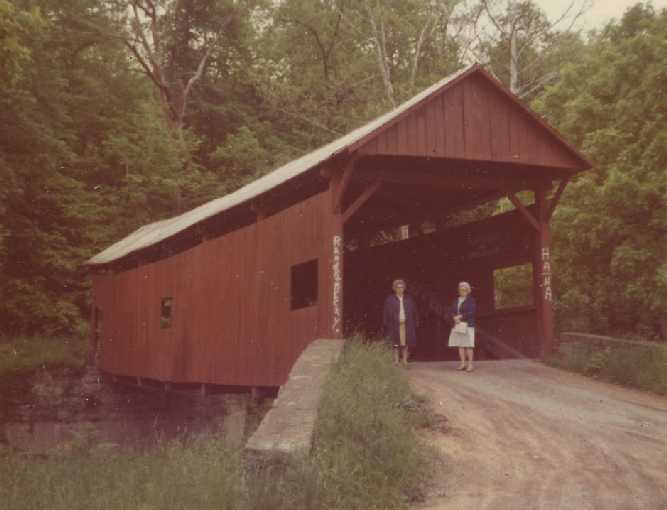
Martin's Mill or Bissell Bridge, Amwell-West Bethlehem, Washington County, PA. Built 1850 Collapsed 20 Mar 1984
May 1973 Photo, Thomas G. Kipphorn Collection
Comments:
Although it is most often listed with Amwell, the entire bridge may have been in West Bethlehem Township. LR62082 (Ten Mile Road - SR2020) seems to be the dividing line and the bridge was just a few feet southeast of that, in West Bethlehem Township. (NOTE: Ten Mile Creek is the dividing line.) It had tie rods underneath for added support. The first bridge at the site was built in 1850. Just a few men were trying to raise one side and one was killed when they failed. This bridge was flooded out in 1888 and a new bridge was built in 1889." (Falk) It collapsed on March 20, 1984. In Penn Pilot aerial photography dated to October 4, 1967, the covered bridge is standing, oriented east-southeast to west-northwest at the base of a "T" interection with Ten Mile Road (SR2020 - LR62082) on T323. The road can be seen in current aerial imagery, but has apparently been abandoned, as the course is not shown, or identified by name on the hybrid views of any online mapping sites except for Mapmart, which has it nameless. The current USGS topographic map shows the road and crossing. Coordinates were gathered from this. It is quite probable that the abutments are still standing.
Sources:
Lane, Oscar F.. World Guide to Covered Bridges, 1972, page 72
Moll, Fred J.. Pennsylvania's Covered Bridges - Our Heritage, 2004, pages 136-137
Kipphorn, Thomas. Information received by email, August 2008

Compilation © 2021 Covered Spans of Yesteryear


Home | Copyright Notice | Reports | Credits | Unidentified Bridges | FAQ | Links

www.lostbridges.org