| SQPC Number: | QC/61-70-02 | | County: | Témiscamingue County | | Township: | Latulipe - Gaboury | | Town/Village: | Latulipe-et-Gaboury | | Bridge Name: | Landry | | Crosses: | Rivière Fraser | | Truss type: | Town variation | | Spans: | 1 | | Length: | 107', 33m | | Roadway Width: | | | Built: | 1932 | | Builder: | | | When Lost: | standing | | Cause: | | | Latitude: | N47 23.809 | | Longitude: | W079 02.867 | | See a map of the area
Topographic map of the area | | Directions: | 0.4 miles (0.6 km) east of Ottawa River crossing on QC382 in Latulipe, then 2.1 miles (3.4 km) south on Rue du Carrefour Sud (becomes Monte du Rang 9) and right 0.6 miles (1.1 km) on Route du 9e Rang Ouest. |
|
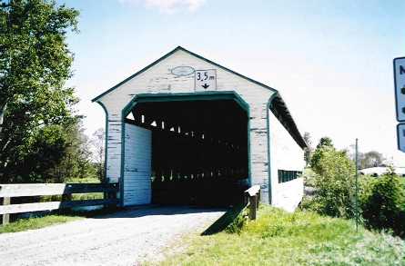
Pont Landry, Latulipe - Gaboury, MRC de Témiscamingue, QC Built 1938
Bill Caswell Photo, August 30, 2003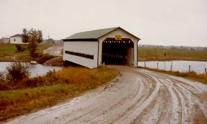
Pont Landry, Latulipe - Gaboury, MRC de Témiscamingue, QC Built 1938
Richard E. Roy Collection (1973)
|
Sources:
http://www.mtq.gouv.qc.ca/portal/page/portal/grand_public/vehicules_promenade/reseau_routier/structures/ponts_couverts/visite_ponts/abitibi-temiscamingue
Arbour, Gérald & Forest, Gaétan. List of Québec Bridges, 2006
National Society for the Preservation of Covered Bridges. World Guide to Covered Bridges, 2021, page 178 |