| Inventory Number: | IN/14-07-02 | | County: | Brown County | | Township: | Washington | | Town/Village: | | | Bridge Name: | Ramp Creek or Brown County State Park | | Crosses: | North Fork Salt Creek | | Truss type: | Burr | | Spans: | 1 | | Length: | 100' floor, 110' roofline | | Roadway Width: | | | Built: | 1838 (M1932) | | Builder: | Henry Wolf | | When Lost: | standing | | Cause: | | | Latitude: | N39 11.728 | | Longitude: | W086 12.990 | | See a map of the area
Topographic map of the area | | Directions: | 1.7 miles east of jct IN46/135 in Nashville on IN46/135, then 0.1 miles right into the north entrance of Brown County State Park to the bridge. East-southeast of Nashville. |
|
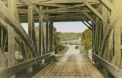
Ramp Creek Bridge, Washington, Brown County, IN Built 1838
Richard Donovan / Trish Kane Collection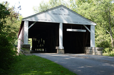
Ramp Creek Bridge, Washington, Brown County, IN Built 1838
© Lisa Plamondon
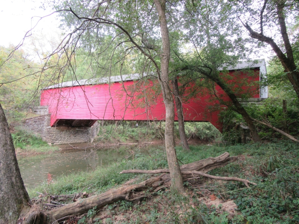
Ramp Creek or Brown County State Park Bridge, Washington, Brown County, IN Built 1838 (M1932)
Bill & Jenn Caswell Photo, September 27, 2015
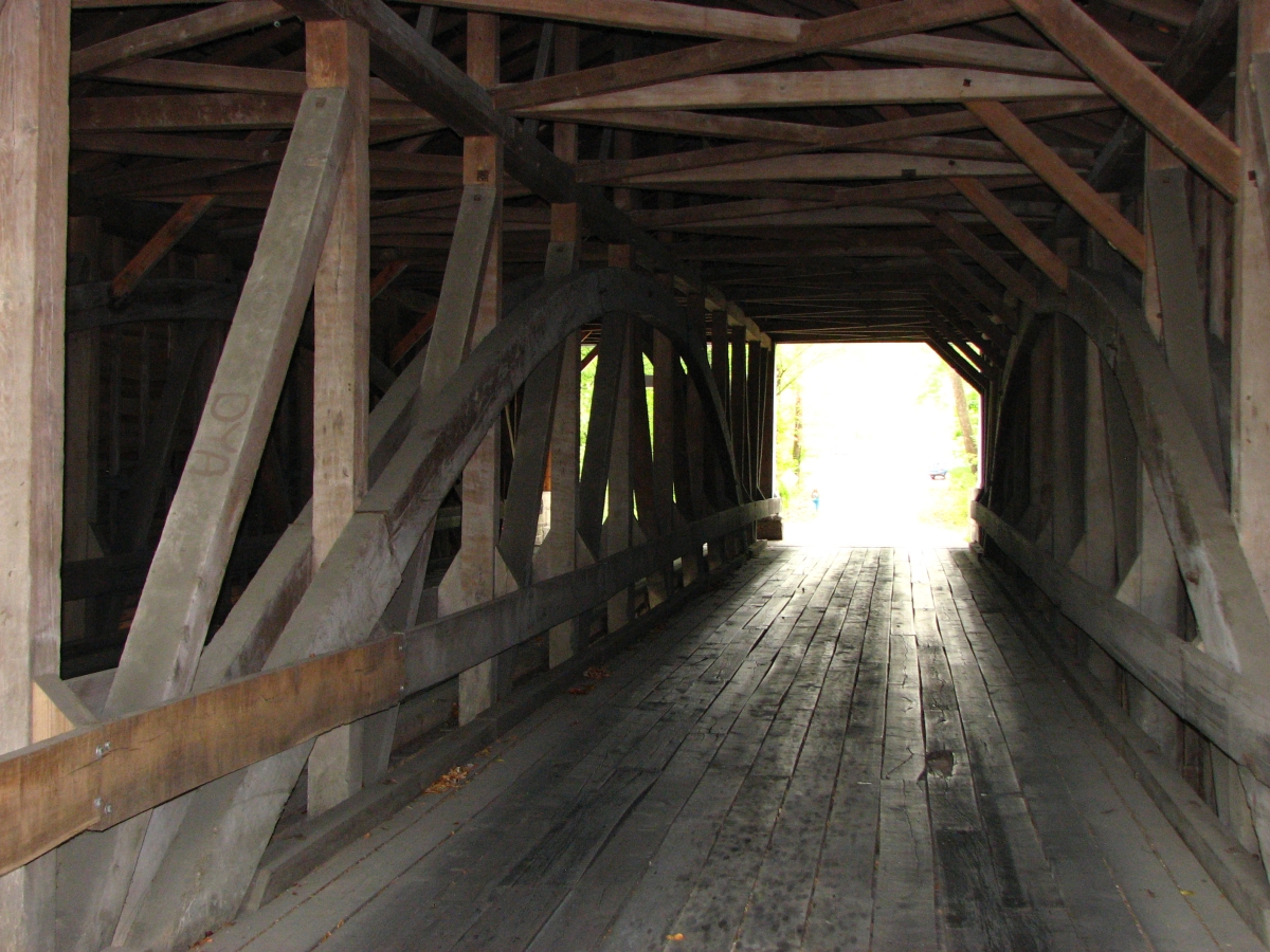
Ramp Creek or Brown County State Park Bridge, Washington, Brown County, IN Built 1838 (M1932)
Bill & Jenn Caswell Photo, September 27, 2015
|
Sources:
Ketcham, Bryan E.. Covered Bridges on the Byways of Indiana, 1949, page 48
Gould, George E.. Indiana's Covered Bridges Thru the Years, 1977
County History Preservation Society (no longer accessible). Covered Bridges of Indiana, 2002, http://www.countyhistory.com/coveredbridge/brown2.htm
Travis, Dale. 'Indiana Covered Bridges List', updated to 11 Feb 2005, http://www.dalejtravis.com/cblist/cbin.htm (8 Mar 2005)
National Society for the Preservation of Covered Bridges. World Guide to Covered Bridges, 2021, page 14 |