| Inventory Number: | ME/19-09-03 | | County: | Oxford County | | Township: | Lincoln Plantation | | Town/Village: | Wilson's Mills | | Bridge Name: | Bennett-Bean | | Crosses: | Magalloway River | | Truss type: | Paddleford | | Spans: | 1 | | Length: | 100' roof, 84', 92' floor | | Roadway Width: | 14’- 6” | | Built: | 1898 | | Builder: | Mason Brothers | | When Lost: | standing | | Cause: | | | Latitude: | N44 55.149 | | Longitude: | W071 02.301 | | See a map of the area
Topographic map of the area | | Directions: | 1.6 miles south of Wilson's Mills on ME16, then 0.3 miles right on Littlehale Rd. On bypassed section of road. |
|
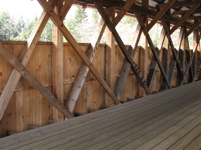
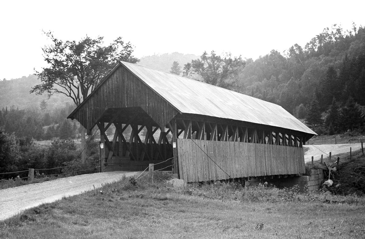
Bennett Bridge, Lincoln Plantation, Oxford County, ME Built 1898
Bill Caswell Photo, November 2007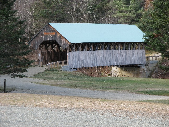
Bennett Bridge, Lincoln Plantation, Oxford County, ME Built 1898
Bill Caswell Photo, November 2007
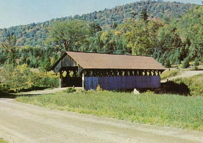
Bennett Bridge, Lincoln Plantation, Oxford County, ME Built 1898
Herbert Walker Photo, NSPCB Archives
Bennett Bridge, Lincoln Plantation, Oxford County, ME Built 1898
Richard E. Roy Collection
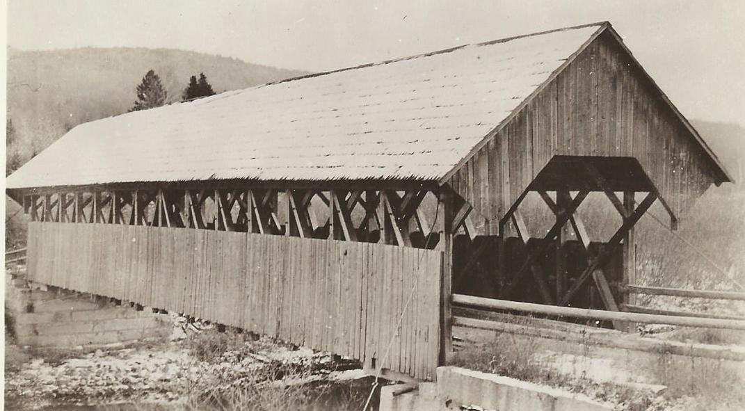
Bennett-Bean Bridge, Lincoln Plantation, Oxford County, ME Built 1898
November 5, 1924 Photo, Maine Department of Transportation Archives
Bennett-Bean Bridge, Lincoln Plantation, Oxford County, ME Built 1898
Earll Richard Stone Photo
|
Sources:
National Society For the Preservation of Covered Bridges. Covered Bridge Topics, Volume LIX, No. 3, Summer 2001, page 8
Conwill, Joseph D.. Images of America - Maine's Covered Bridges, 2003, page 67
National Society for the Preservation of Covered Bridges. World Guide to Covered Bridges, 2021, page 36 |