| Inventory Number: | NB/55-06-24 | | County: | Kings County | | Township: | Hampton | | Town/Village: | | | Bridge Name: | Smithtown or Hammond River #3 | | Crosses: | Hammond River | | Truss type: | Howe & Queen | | Spans: | 1 | | Length: | 187', 57m | | Roadway Width: | | | Built: | 1914 | | Builder: | | | When Lost: | standing | | Cause: | | | Latitude: | N45 27.840 | | Longitude: | W065 48.267 | | See a map of the area
Topographic map of the area | | Directions: | 1.4 miles (2.2 km) east of jct NB1 on NB111, then 11.0 miles (17.7 km) left on NB860 and 0.4 miles (700 m) right on Damascus Rd. West of Upham. | | Comments: | |
|
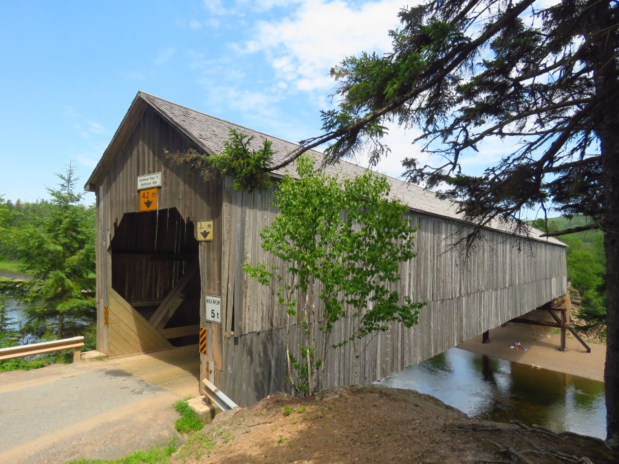
Smithtown or Hammond River #3 Bridge, Hampton, Kings County, NB Built 1914
Bill & Jenn Caswell Photo, July 10, 2018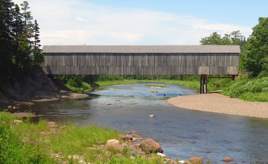
Smithtown or Hammond River #3 Bridge, Hampton, Kings County, NB Built 1914
Bill & Jenn Caswell Photo, July 10, 2018
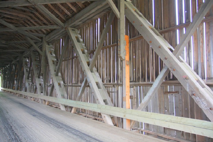
Smithtown or Hammond River #3 Bridge, Hampton, Kings County, NB Built 1914
Warren White Photo, June 15, 2011
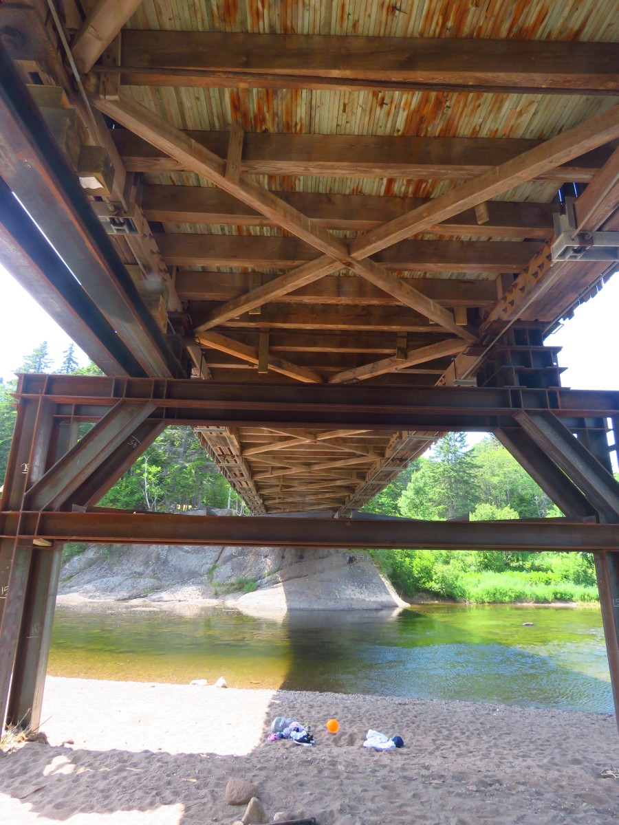
Smithtown or Hammond River #3 Bridge, Hampton, Kings County, NB Built 1914
Bill & Jenn Caswell Photo, July 10, 2018
|