Documenting North America's past & present covered bridges


Home

Palo Alto or Fitchner, Bedford County

If you find errors in the data please contact Bill Caswell.

If you would like to provide information on covered bridges that no longer exist from your state, or adopt a state to work on, we would certainly welcome your assistance. Please contact Trish Kane for more information.

Inventory Number: PA/38-05-21
County: Bedford County
Township: Londonderry
Town/Village: Palo Alto
Bridge Name: Palo Alto or Fitchner
Crosses: Gladdens Run
Truss type: Multiple King
Spans: 1
Length: 56'
Roadway Width: 13'
Built: 1880
Builder:
When Lost: standing
Cause:
Latitude: N39 45.814
Longitude: W078 45.087
See a map of the area
Topographic map of the area
Directions: 350 feet west of PA96 on Kennels Mill Rd. (SR3002), then just left on private driveway. West edge of Palo Alto.

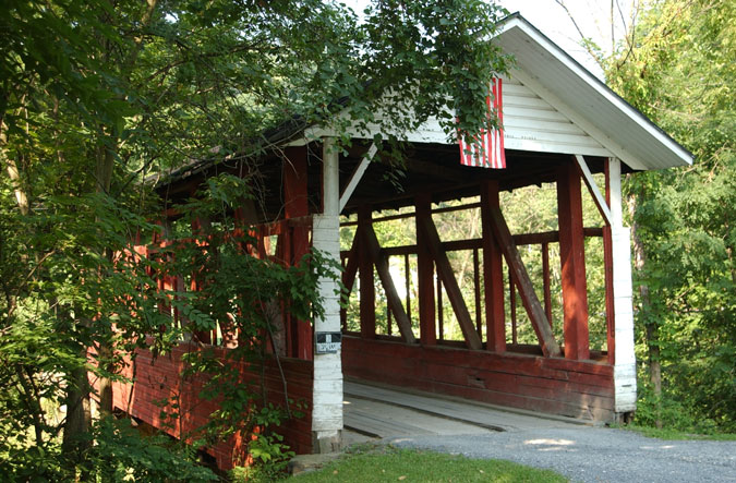
Palo Alto or Fitchner Bridge, Londonderry, Bedford County, PA. Built 1880
© Lisa Plamondon
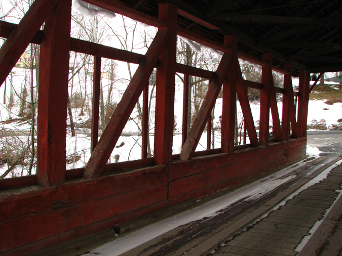

Palo Alto or Fitchner Bridge, Londonderry, Bedford County, PA. Built 1880
Bill Caswell Photo, February 27, 2010


Palo Alto or Fitchner Bridge, Londonderry, Bedford County, PA. Built 1880
Bill Caswell Photo, February 27, 2010
Palo Alto or Fitchner Bridge, Londonderry, Bedford County, PA. Built 1880
Bill Caswell Photo, February 27, 2010

Comments:
Private. 6-panel truss. "There was much faint printing on the portal. I could make out the following: 'Blt. Sept. 1880. Contractor-builder Hammon Walter. Walk your horses across this bridge $5 Fine'. I have good reason to believe that the contractor was a man by the name of Mattingly" (Falk). Off the south side and perpendicular to Kennels Mill Road (SR3002 - LR05007). Roads have been shifted around somewhat, but when the covered bridge was still being used, it was the main crossing over Gladdens Run for what was to later become present Hyndman Road, or Route 96 (SR0096 - Route 356 under the old numbering system) which originally ran from the southern end of the bridge south to the village of Stringtown. What is left of the old road is called Covered Bridge Road, but along with the covered bridge, is mislocated on most of the mapping sources. The southern portion of the old road into Stringtown is partly taken up by the end of Stringtown Hollow Road (T311) as it enters the village. It appeared, at least in Penn Pilot aerial photography dated to July 12, 1939, that the covered bridge was still being used to some capacity, but that the course of Route 96 had already been changed, with the road crossing about ½ mile south-southeast and the old road being abandoned.
Sources:
Evans, Benjamin D. & June R.. Pennsylvania's Covered Bridges, 2001, page 29
Moll, Fred J.. Pennsylvania's Covered Bridges - Our Heritage, 2004, pages 78-79
Kipphorn, Thomas. Information received by email, September 2007
National Society for the Preservation of Covered Bridges. World Guide to Covered Bridges, 2021, page 99

Compilation 2026 Covered Spans of Yesteryear

The images in this collection may be protected under copyright law and may only be used for educational, teaching, and research purposes.
If the intended use is beyond these purposes, it is the responsibility of the user to obtain the appropriate permissions from the owner stated in the image's credits.


Home | Copyright Notice | Reports | Credits | Unidentified Bridges | FAQ | Links

www.lostbridges.org