| Inventory Number: | PA/38-19-29 | | County: | Columbia County | | Township: | Franklin | | Town/Village: | | | Bridge Name: | Parr's (Paar's) Mill | | Crosses: | Roaring Creek, North Branch | | Truss type: | Burr | | Spans: | 1 | | Length: | 84', 84'-3" overall, 67' span | | Roadway Width: | 12'-2" | | Built: | 1865 | | Builder: | F.L. Shuman | | When Lost: | standing | | Cause: | | | Latitude: | N40 54.377 | | Longitude: | W076 28.357 | | See a map of the area
Topographic map of the area | | Directions: | 2.9 miles south-southwest of jct PA442 on PA87 then 0.3 miles left on Ashton Hollow Rd. (SR3003) and just left on Parrs Mill Rd. (TR371). 3.5 miles south of Catawissa. |
|

Parr's Mill Bridge, Cleveland-Franklin Built 1865
© Lisa Plamondon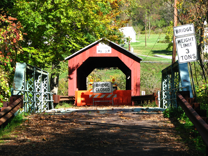
Washington Parr's (Paar's) Mill Bridge, Franklin, Columbia County, PA. Built 1865
Bill Caswell Photo, October 10, 2010
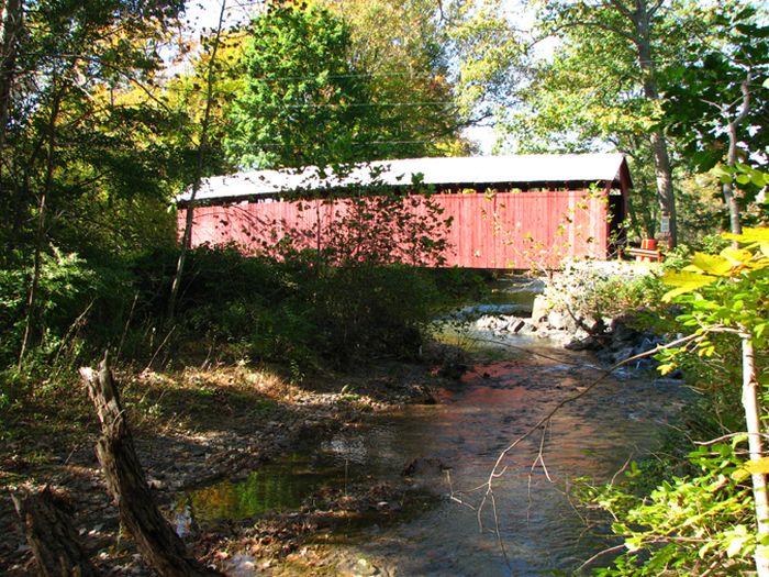
Washington Parr's (Paar's) Mill Bridge, Franklin, Columbia County, PA. Built 1865
Bill Caswell Photo, October 10, 2010
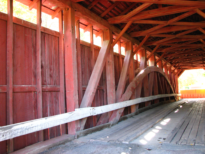
Washington Parr's (Paar's) Mill Bridge, Franklin, Columbia County, PA. Built 1865
Bill Caswell Photo, October 10, 2010
|
Sources:
Evans, Benjamin D. & June R.. Pennsylvania's Covered Bridges, 2001, page 108
The Star of the North (Bloomsburg), November 8, 1865, p.2.
Travis, Dale. Pennsylvania Covered Bridges List, updated to 26 Aug 2004, http://www.dalejtravis.com/cblist/cbpa.htm (23 Sep 2004)
Kipphorn, Thomas. Information received by email, May 2006
National Society for the Preservation of Covered Bridges. World Guide to Covered Bridges, 2021, page 110 |