Documenting North America's past & present covered bridges


Home

David Bentzel's Mill or Elcesser's Mill, York County

If you find errors in the data please contact Bill Caswell.

If you would like to provide information on covered bridges that no longer exist from your state, or adopt a state to work on, we would certainly welcome your assistance. Please contact Trish Kane for more information.

Inventory Number: PA/38-67-02x
County: York County
Township: Conewago - Manchester
Town/Village:
Bridge Name: David Bentzel's Mill or Elcesser's Mill
Crosses: Little Conewago Creek
Truss type: Burr
Spans: 1
Length: 97'
Roadway Width: 18'
Built: c1860
Builder:
When Lost: 22 Jun 1972
Cause: Destroyed by Hurricane Agnes
Latitude: N40 00.925
Longitude: W076 47.749
See a map of the area
Topographic map of the area
Directions: 2.5 miles northeast of Dover on PA921, then 0.8 miles right on Greenbriar Road (LR66403 - SR4011).

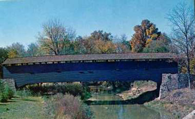
The Bentzel's Mill Bridge, PA, was built before 1820 and used until the late 1950's when it was replaced and left standing. It was destroyed by Hurricane Agnes in 1972.
Photo Courtesy Kim McKee


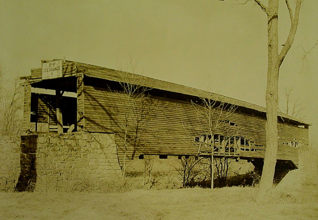
David Bentzel's Mill or Elcesser's Mill Bridge, Conewago-Manchester, York County, PA Built c1860 Destroyed by Hurricane Agnes 22 Jun 1972
Bucknell University: Nelson F. Davis Covered Bridges Photograph Collection, November 14 31, 1936

Comments:
County Bridge #186. 11-panel truss. Based on records in the York County Archives, the bridge was located on LR66043 (Greenbriar Road) and was photographed for a county bridge inventory dated March 17, 1926. The bridge inventory records the distance between abutments as 100 feet and shows a bridge with a stepped portal façade. The bridge was probably built in 1860 based on a bridge bids article dated July 3, 1860 that stated: "One across Little Conewago creek at David Bentzel's mill, in Manchester and Conewago townships, to be a covered bridge 100 feet between abutments." News of a flood on June 1, 1889 stated that the bridge at Bentzel's had been destroyed. A 15-ton concrete mixer truck fell through the floor of the 1.5-ton posted bridge November 20, 1947, killing the driver and severely injuring a pedestrian who fell through the hole created. It was in very bad condition when the World Guide numbering system went into effect in 1959, as were so many other state-owned covered bridges and was bypassed in 1960. Finally, it was acquired by, and restored through the efforts of the Conservation Society of York County in the early 1960’s, only to be destroyed by floodwaters from Tropical Storm Agnes on Thursday, June 22, 1972. At the time of destruction, it was the last covered bridge entirely in York County.
Sources:
The York Gazette, July 3, 1860.
National Society For the Preservation of Covered Bridges. Covered Bridge Topics, Volume XXX, No. 3, October 1972, page 12
National Society For the Preservation of Covered Bridges. Covered Bridge Topics, Volume XXXIX, No. 3, Summer 1981, page 14
Kipphorn, Thomas. Information received by email, October 2009

Compilation © 2024 Covered Spans of Yesteryear

The images in this collection may be protected under copyright law and may only be used for educational, teaching, and research purposes.
If the intended use is beyond these purposes, it is the responsibility of the user to obtain the appropriate permissions from the owner stated in the image's credits.


Home | Copyright Notice | Reports | Credits | Unidentified Bridges | FAQ | Links

www.lostbridges.org