| Inventory Number: | PA/38-52-08x / NY-36-05x | | County: | Pike County / Orange County | | Township: | Westfall - Deer Park | | Town/Village: | Millrift - Old Bolton | | Bridge Name: | Sawmill Rift Railroad or Bolton Basin Railroad | | Crosses: | Delaware River | | Truss type: | Uncovered McCallum (1-Through, 4-Pony) | | Spans: | 5 | | Length: | 800' | | Roadway Width: | | | Built: | c1847 | | Builder: | | | When Lost: | Unknown | | Cause: | | | Latitude: | N41 24.38 | | Longitude: | W074 44.51 | | See a map of the area
Topographic map of the area | | Directions: | New York and Erie Railroad. |
|
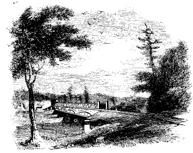
Sawmill Rift or Bolton Basin Bridge, Westfall-Deer Park, Pike County, PA. Built c1847
Harper's New York and Erie Rail-Road Guide Book, 1855, page 69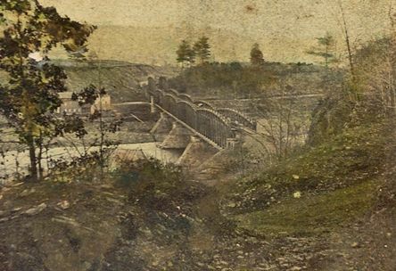
Sawmill Rift Railroad or Bolton Basin Railroad Bridge, Westfall-Deer Park, Pike County, PA. Built c1847
Todd Clark Collection
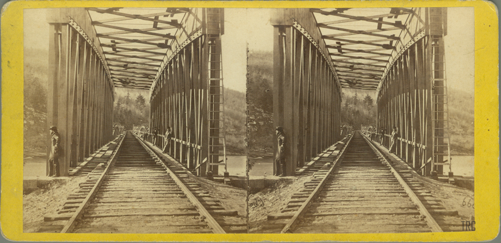
Sawmill Rift Railroad or Bolton Basin Railroad Bridge, Westfall-Deer Park, Pike County, PA. Built c1847
Todd Clark Collection
|